Español
  Inglés
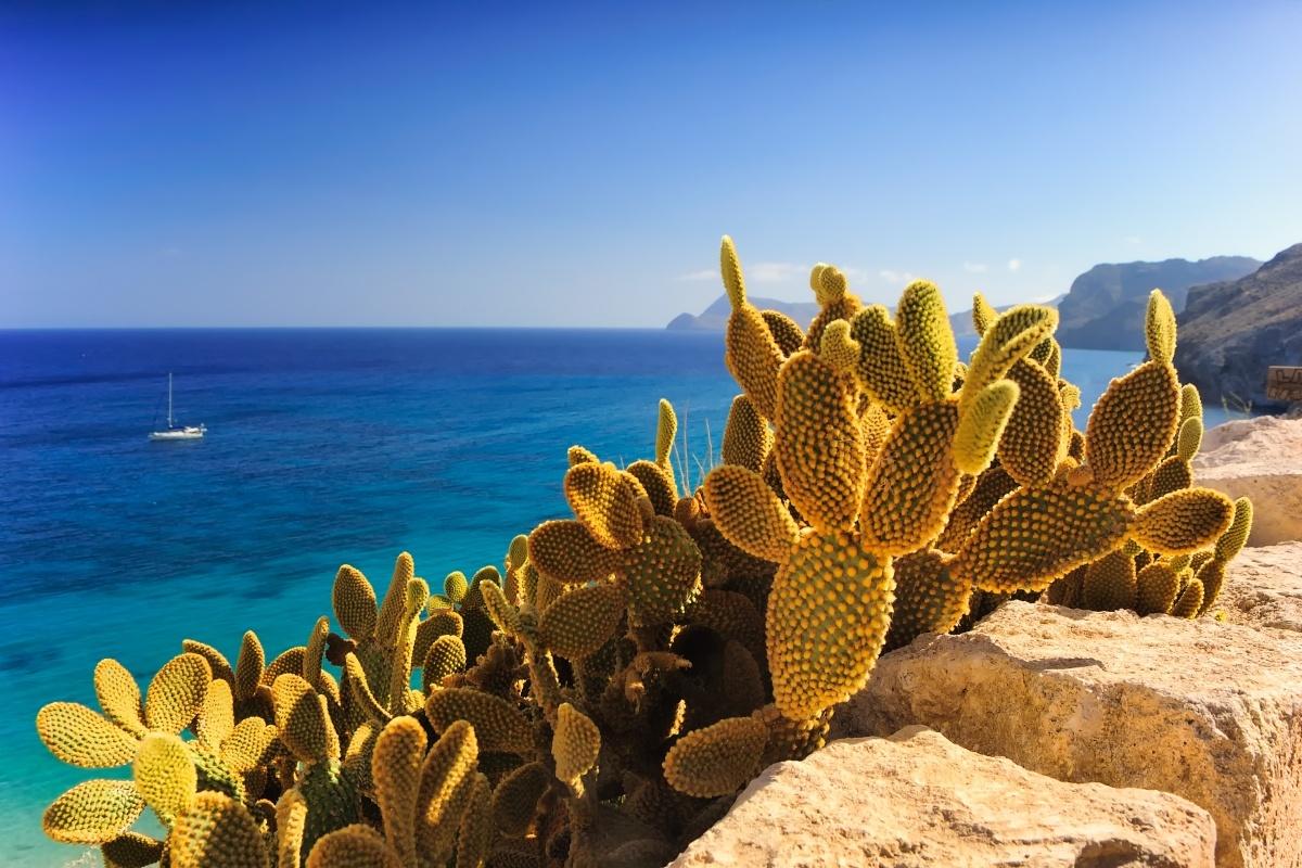
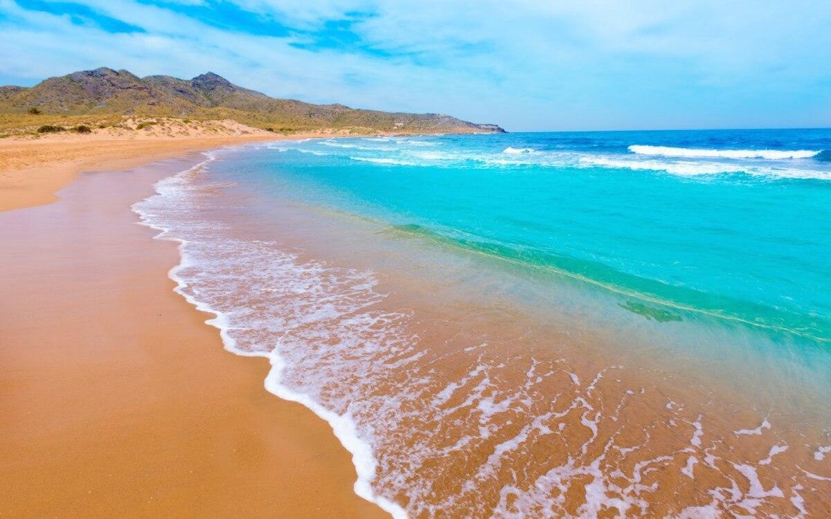
From FURGOCASA we would like to invite you to discover the Costa Calidad on a Campervan motorhome. Two seas on one coastline -the Mar Menor and the Mediterranean- , impressive cliffs, heavenly beaches of endless white sand, lively ports and wild coves with crystal-clear water, more than 3,000 hours of sun a year and mild temperatures -even in winter- with a yearly average of more than 19ºC.
This is the Costa Calida, the ideal place to spend some days relaxing both in winter and summer. The perfect site to rent one of our campers vans and let yourself fall in love with the tranquility and the beauty of the place.
From the fishing town of Águilas to the white dunes of the beach of El Mojón in San Pedro del Pinatar, stretch kilometre after kilometre of beaches and deserted coves awaiting the arrival of the bather, the sailor, the diver or the fisherman.
Discover everything these destinations can offer you.
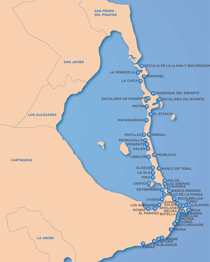
Map of the trip:
El Mar Menor
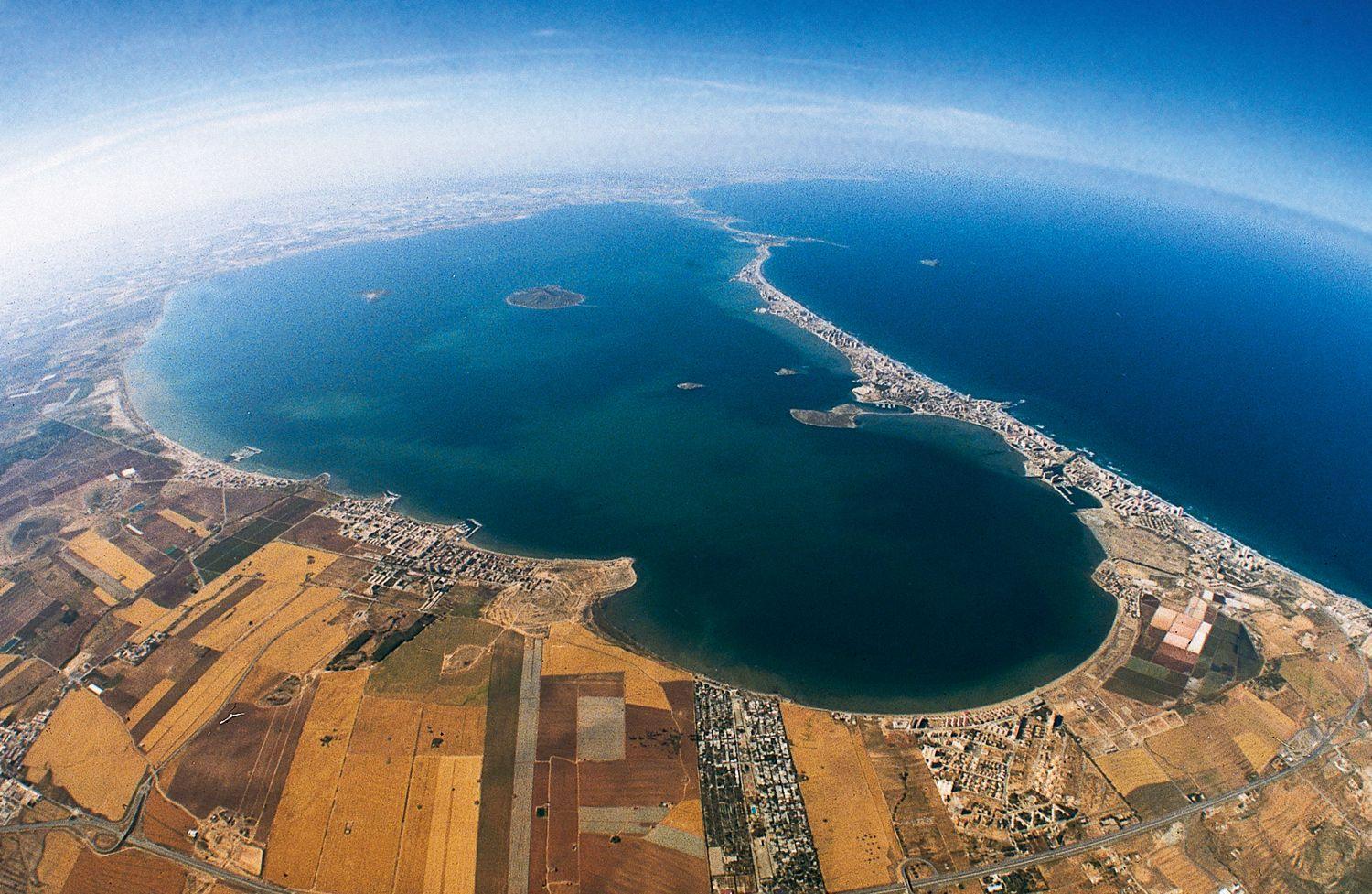
Mar Menor, Murcia
The Mar Menor is -in spite of its name- Europe's biggest salt water lagoon, and it is separated from the Mediterranean Sea by La Manga, a strip of land which is 22km long. This natural setting has an idyllic microclimate and perfect conditions to enjoy nautical sports. Moreover, here you will find a very particular combination of fishing traditions and modernity, impossible to find anywhere else.
La Manga: between two seas
The descriptive name of La Manga (the sleeve) holds an interesting geographical layout which has become one of the symbols that best identifies the coast of Murcia as a tourist resort: a chain that stretches along approximately 24 km from Cabo de Palos to the Punta del Mojón, and is the natural limit of the salt water lake known as the Mar Menor. Originally, what is now known as La Manga del Mar Menor was a bay open to the Mediterranean; at either end, volcanic reefs gradually held back the sand and sediment that was dragged along by the sea currents to form a sandy column of dunes and rock vegetation and long beaches in contact with two seas: the Mediterranean and the Menor. La Manga is a narrow piece of land with a width that varies between 200 m and 1 and a half km. It is cut off by natural channels that keep the two seas in contact with each other; the so-called "golas" allow water from the Mediterranean into the lake. As such, the space was kept virgin until the 60's, when La Manga was "discovered" as a tourist resort and underwent a transformation which included the urbanisation of the area and the construction of tourist infrastructures.
Nowadays, everything in La Manga has been designed to enhance the visitor's stay. Complete hotel installations, with a network of establishments with maximum qualification (including a five-star hotel), located at strategic points, apartment complexes, sailing ports, sailing schools, recreational centres, supermarkets, shops, bars, discos... everything you need for a complete holiday. In winter and autumn, La Manga is kept open, since its population is constant all year round. Winter is an ideal period for those in search of peace and quiet, with the necessary services and infrastructures.
La Manga, Map
Due to it being located between two seas, La Manga is also an ideal place for water sports. There are sailing and skiing schools that run periodical courses, as well as windsurfing and catamarans. The Mediterranean can be enjoyed by those who prefer high waves for windsurfing and the entire coast also offers a series of areas that are ideally suited and perfectly isolated for diving, such as Cabo de Palos and the rocky depths next to Isla Grosa.
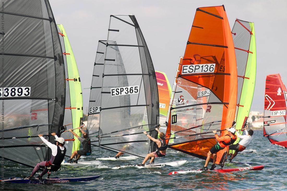
Windsurf in Mar Menor
Furthermore, visitors to this area can enjoy all the advantages of the Sailing Station of the Mar Menor, which in keeping with the ski station concept, offers a set of sailing, sports and tourist infrastructures together with hotels, accommodation and establishments for leisure and learning grouped together in one place: the entire Shore area of the Mar Menor and La Manga. The exceptional climatic conditions of the area (315 days of sunshine per year and an average annual temperature of 18ºC) are ideal for the continuous practice of water sports.
San Javier
Located on the coast of the Mar Menor, its history began after the period of the Berber invasions in the area. It arose around a shrine that was built at the beginning of the 17th century and dedicated to the Apostle San Francisco Javier.
Its territory, which is dedicated to agriculture and the sea, has the outstanding coastal locations of Santiago de la Ribera and La Manga del Mar Menor, both of eminent tourist interest. Santiago de la Ribera was created in 1888 with the construction of a shrine dedicated to the Apostle St. James. Currently, this modern-looking town has a beautiful sea front and holds on to its fishing village flavour.
Moreover, its special qualities for water sports and its wide range of leisure and accommodation possibilities have turned it into a magnificent tourist resort. San Javier perhaps widens the options for the rural tourist with its many inland villages and protected areas away from the coast, such as Cabezo Gordo, and make it an excellent alternative to bear in mind if you're looking for something other than its excellent beaches.
San Pedro del Pinatar
San Pedro del Pinatar is at the touristic heart of the Costa Cálida. Situated between the Mar Menor and the Mediterranean Sea, this small seaside town is famous for its fishing background, therapeutic mud baths, salt flats and vast stretches of sand.
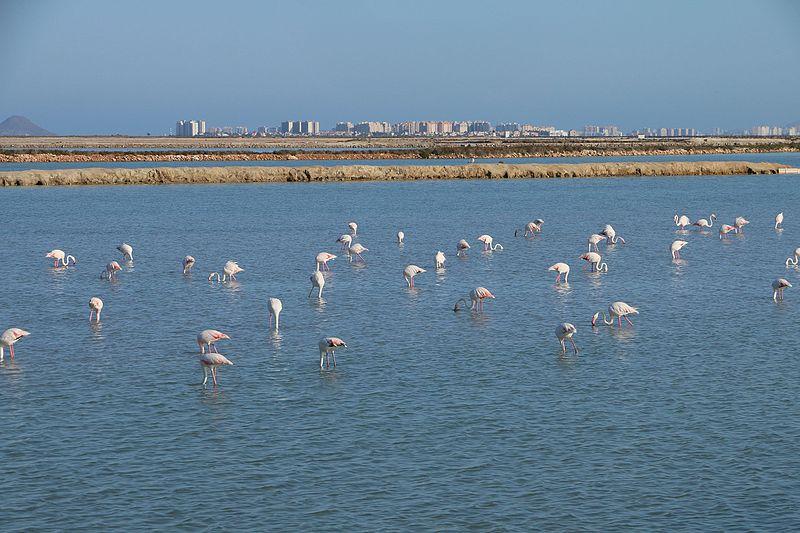
Salinas de San Pedro, San Pedro del Pinatar
Located at the northern end of the Mar Menor, its name comes from a small church the fishermen dedicated to San Pedro in an area of pine trees. With its agricultural and fishing character, it has busy tourist activity in Lo Pagán, where its mud baths are particularly famous and good for your health.
Its history stretches back to the Roman era, from which remains of houses have been discovered and during which the exploitation of the salt flats of Coterillo was begun; salt flats which are still working today. These wetlands were formed with the dunes and the beach of La Llana, which is the oldest of the Regional parks of Murcia, and which is a refuge for over one hundred bird species, among which the flamingo is worthy of particular mention.
Los Alcazares
Found on the shores of the Mar Menor, this town has for generations been considered the ideal place to relax as you enjoy its beaches and water sports. Today, Los Alcázares is one of the top tourist destinations in the whole region.
Located next to the shores of the Mar Menor, it offers seven kilometres of coastline from Los Narejos to Punta Brava and dedicates a large part of its economic activity to the industry of services and tourism.
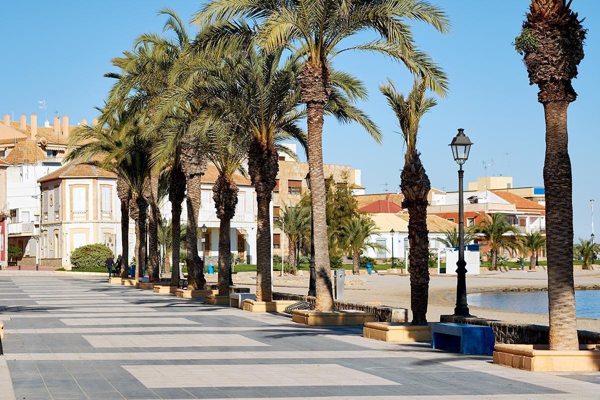
Paseo de los Alcazares, Los Alcazares, Murcia
The name of the municipality comes from the Arabic word 'Al Kazar', which means palace or 'house of nobles', buildings that were constructed by the Arabs for their holidays and relaxation in this place. Furthermore, the Moors discovered the excellent properties of the water of the Mar Menor, which they enjoyed in the ancient Roman baths that were located there and which they reused. With the Christian repopulation, Los Alcázares became truly important as a port for fishing and trade, given its excellent strategic position.
Cartagena litoral y La Union
Cartagena, with more than 3,000 years of history, has been the scene of some of the most outstanding passages throughout time. This Punic, Roman, military and art nouveau city offers nowadays so many things to see and do that it has become one of the most appealing destinations in the Mediterranean area.
Cartagena, Murcia
The coast of Cartagena is very varied and along its entire length has different landscapes ranging from high cliffs with hidden coves to large bays to delight any bather, from those in search of comfort and the entire range of services to travellers looking for untouched countryside.
If the visitor starts his journey along the coast of Cartagena from the west, he will come across the villages of Isla Plana and La Azohía, which, with their large sandy beaches and mountain views, are traditional summer resorts.
La Azohía has a beautiful polygonal defence tower from the 16th century and is famous for tunny fishing, an age-old art practised by the Arabs. Beyond La Punta de la Azohía, the coast changes to cliffs, with solitary beaches such as Cala Cerrada and Cala Abierta, excellent places for bathing, accessible by sea or by walking down paths, ideal for those who enjoy both active tourism and peace and quiet. After rounding Cabo Tiñoso, an excellent vantage point at an altitude of over 300 m, the traveller reaches an area of virgin coast, dominated by the Mountain Range of La Muela, which has been protected as a result of its high natural value. This area contains the fishing village of El Portús, with its nudist camp site.
Playa de Calblanque, Cartagena, Murcia
To the east of Cartagena, there are different landscapes which include the Regional Park of Calblanque, a privileged area of the coast of Murcia. It has a wealth of species of fauna and flora, with geographical formations as varied as coves, large beaches, fossil dunes, salt flats and mountain slopes, with various routes for visiting the park. Further on are the protected coves of Cala Flores and Cala Reona, near to Cabo de Palos. This area, which also includes the surroundings of Islas Hormigas and Isla Grosa, is especially interesting for divers due to the fauna and flora that live on the rocky sea bottom.
In the Mar Menor area, Playa Honda, Mar de Cristal and Islas Menores are villages of summer and seafaring tradition and are popular with the faithful tourist who returns year after year in search of its peaceful environment. This also happens in Los Nietos, a small fishing village which fills to the brim in summer. Further to the north, in Los Urrutias, is the Regatta Club of the Mar Menor. In the village of Los Belones, very near to La Manga, there is an important Golf complex with 54 holes; it also has tennis courts, areas for learning to play golf and a gymnasium. A complete sports offer in beautiful natural surroundings. There are also two horse riding centres in the same area for those who prefer a relaxing trek on horseback.
The coast of Cartagena is completed with La Manga (mentioned before).
La Union's mining history has been a deciding factor in shaping and forming the landscape on this short stretch of the coast. The range in colours of the various minerals give the area an exotic beauty which the visitor can appreciate on the journey towards the coast.
Cartagena
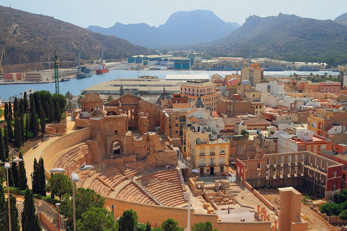
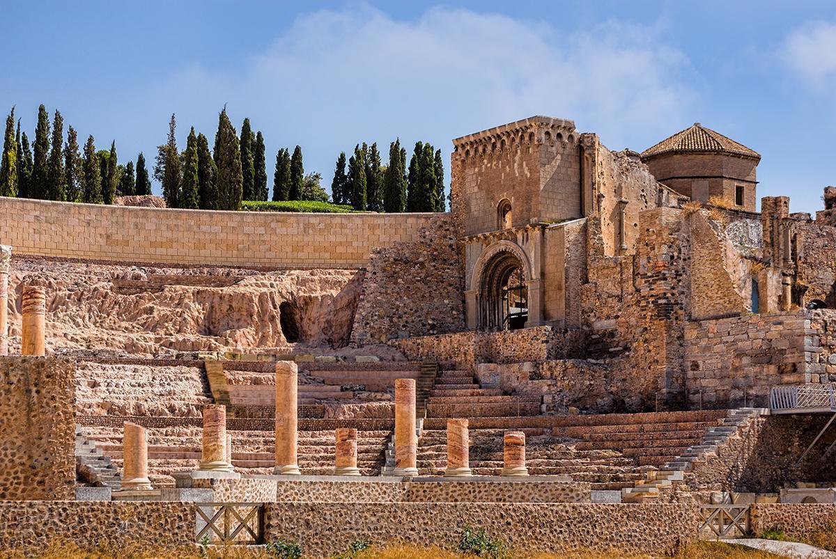
Cartagena is a city with more than 2,500 years of history. Each corner, street and square of the city offers travellers monumental examples of its splendorous historical past, of the civilizations that put in at its port.
The Cartagena inititiative, "Port of Cultures", opens up a wide range of possibilities which enable the visitor to enjoy the city's heritage and cultural riches: to find out about its origins by visiting the Punic Walls, evidence of the founding of the city by the Carthaginian Asdrubal in the year 227 B.C., where a Visitor Activity Centre will explain all about that fundamental part of its history and the local archaeology.
Ruinas Teatro Romano, Cartagena, Murcia
Cartagena "Port of Cultures" has developed these riches into a unifying theme in order to make it more accesssible to visitors. Just by strolling around we soon discover that the city also possesses a military history which takes us right back to mediaeval times when the Castle of the Conception was built. It is here where a Visitor Activity Centre offers information about the city and its history in a place which has been chosen for its privileged setting.
The Cartagena project, "Port of Cultures" is working to increase the city's tourist potential, by making accessibility easier and by enabling people with reduced mobility to enjoy its sightseeing resources to the full: a good example of this is the panoramic elevator which connects the Port with the Castle of the Conception; by improving the street signs in the city, by providing excellent transport for the tourist both by land and sea, and in short, by valuing and giving importance to the whole tourist experience for any visitor who arrives in the city.
Cartagena "Port of Cultures" is the perfect opportunity for this city to become an exceptional tourist destination: we are talking about a well-designed thematic area which enables its visitors to find out all about the invaluable cultural attractions which Cartagena possesses.
This plethora of historical riches is not only a thing of the past: it is still present to this day in the local festivities and celebrations, the most significant of which are the Easter week celebrations and the Romans and Carthaginians festival.
During Easter week the military precision of the penitents' marching, the lavish floral decoration of the thrones, and the richness of the costumes and embroidery, along with the never-ending rivalry that exists between the horse riders ("the californios") and their bitter and dangerous enemies (the "marrajos"), are characteristic in this day and age of the Cartagena processions and parades.
With regard to the other important "fiesta", the month of September is the time of year in which thousands of Cartagena people dress up as Romans and Carthaginians in order to proudly commemorate the events which took place in the city during the course of the Second Punic War.
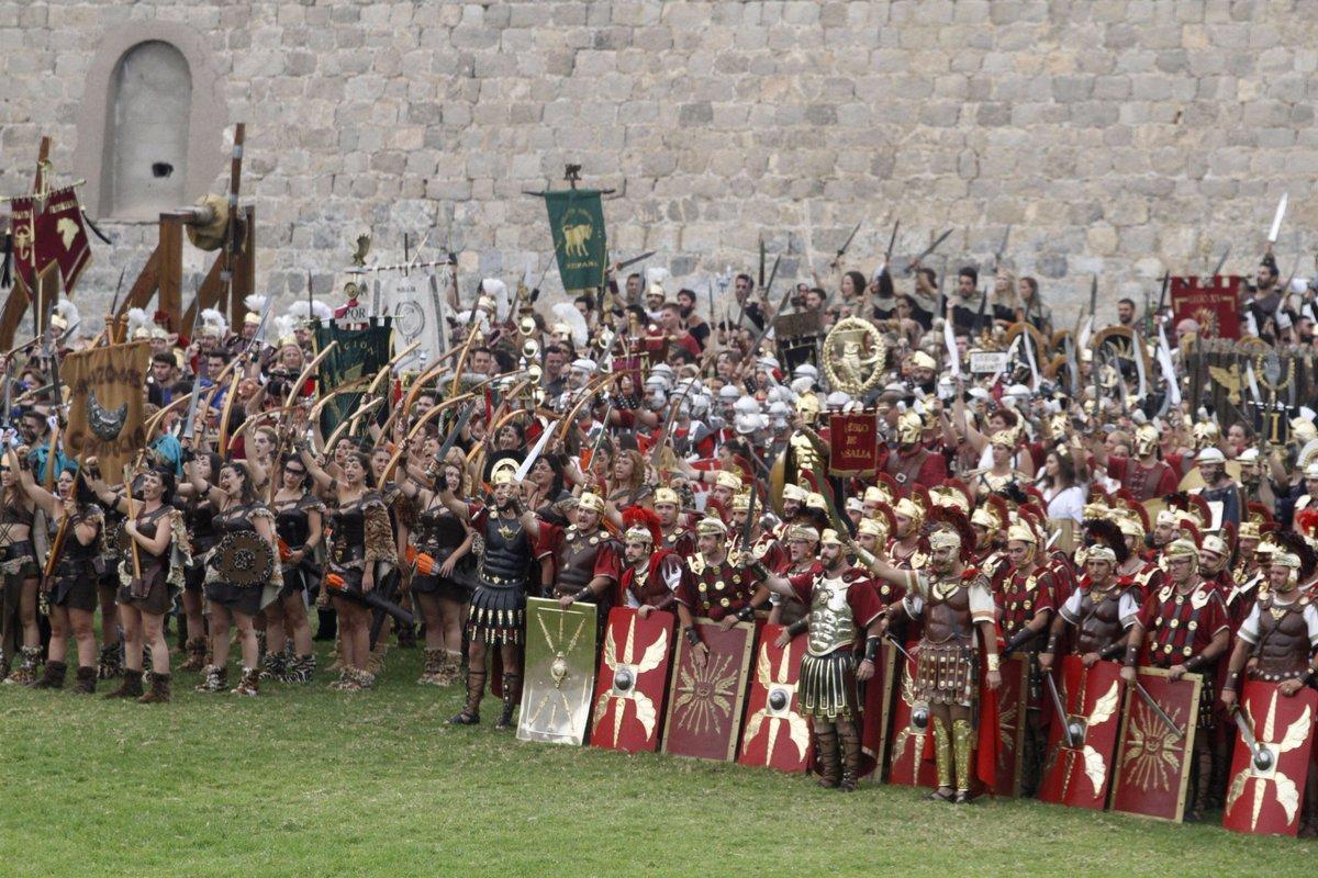
Fiesta de Cartagineses y Romanos, Cartagena, Murcia
The city's festive delights is made complete with the "Mar de Musicas" (Sea of Music) festival, which is a festival of new and world music held during the month of July and which, in spite of its brief history, has achieved a unanimous recognition at both a national and international level.
The visitor will also be able to enjoy the local gastronomy which, in the case of Cartagena, is special in that it is a port, but with the country right nearby. Both fresh and salted fish and seafoods, the very typical "caldero" - a type of fish stew served with rice and garlic - as well as meat and agricultural produce from its fertile inland, all washed down with local wines and accompanied by the traditional drinks of the area such as the asiatico coffee (coffee with condensed milk, cinnamon, lemon and whole coffee beans), which delight the palate of all those who come to find out about its traditional cuisine.
But Cartagena also adds the opportunity to do some rural tourism in some of its inland villages in the district. Quiet areas near natural spaces of environmental interest, ideal for getting closer to nature have the added boon of their proximity to the coast.
La Union
La Unión is located very close to the Mar Menor and Mediterranean Sea beaches. Its culture and landscapes are firmly linked to over 3,000 years of mining activity and flamenco, forming one of the Region of Murcia's destinations with more personality.
La Unión, a municipality located in the southeast of the region of Murcia, between the Mar Menor and the Mediterranean coast, shows a unique and singular landscape. Its mountains, with iron, manganese, zinc, sphalerite or pyrite brushstrokes, give a peculiar touch to the landscape, deeply marked by the traces that the mining industry left behind throughout centuries of activity.
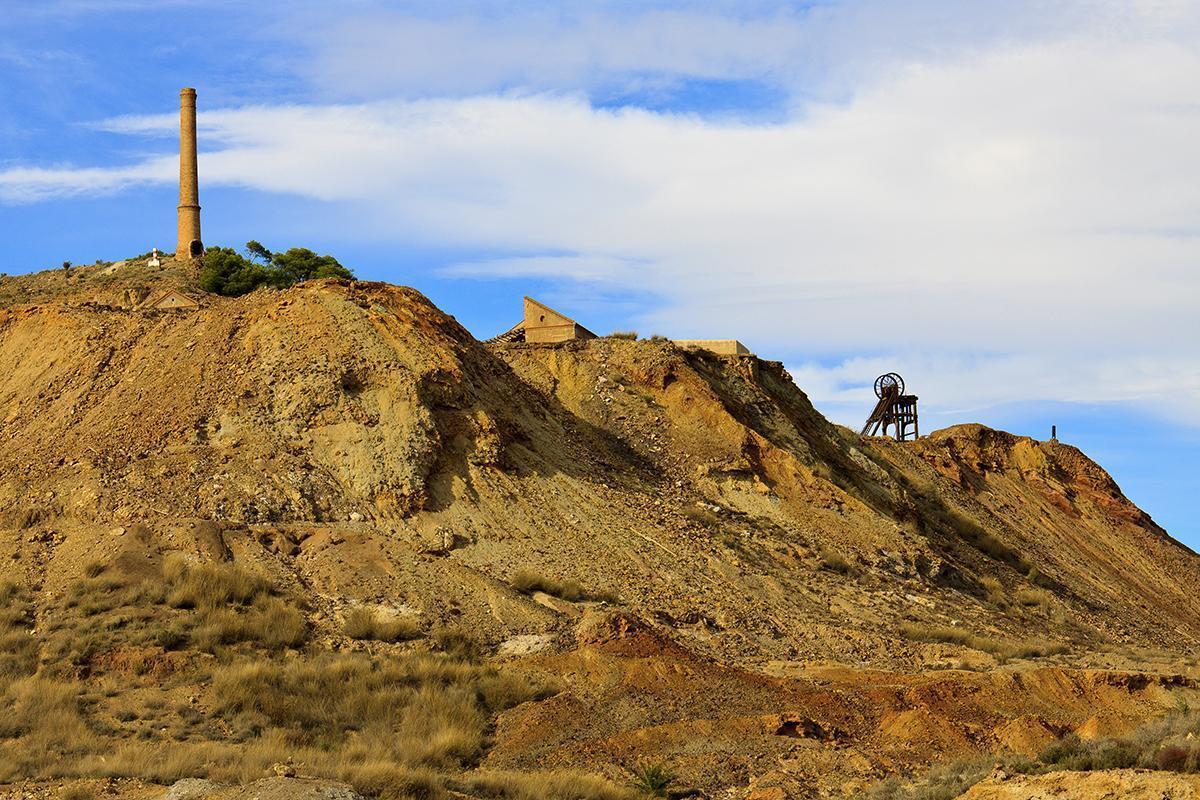
Minas, La Union, Murcia
As an authentic theme park dedicated to mining activity, La Unión may awake the senses of every visitor to go into this topic in depth. And the three museums of the town were built for this purpose.
Built in 1901 as a charity centre dedicated to provide education to workers and their children, the "Liceo de Obreros" now houses the "Museo Minero" (Mining Museum). Whit its many rooms, its mock-up collection and its obvious pedagogic orientation, this museum is undoubtedly one of the best mining museum in Spain .
The "Museo Etnológico" (Ethnological Museum) located in the distric of Roche, brings us closer to the genuine customs and tradicions of this land.
The "Museo Arqueológico Romano" (Roman Archaeological Museum), is to be found in the Portmán district, (in reference to Portus Magnum, the former Roman harbour), and more precisely in the " Antiguo Hospital de Caridad" (Charity Hospital). There can be admired the biggest Roman mosaic preserved in the region, wich belongs to the I-III century AD Roman villa called "Huerta del Paturro" (Paturro's Orchard).
The tourist who walks through La Unión can appreciate unique modern buildings as "La Casa del Piñón", "El Antiguo Mercado Público", la" Iglesia Parroquial de la Virgen del Rosario" and other examples of local architectural tradition which includes the use of brich, such as "El Progreso" o "La Cooperativa".
Anyone who visits La Unión in Holy Week not only will have the privilege of admiring a Passion parade which has been declared a Regional Asset of Tourist Interest. It will also be the opportunity to contemplate the penitents parade whose participants hold in their hands mining tools and light with the typical mining lamp the way of the tercios (marine corps) By this time it is also celebrated the "Feria de Minerales y Fósiles de la Sierra Minera ( a fair of minerals and fossils).
During the first fortnight of August and from 1961 you can enjoy flamenco singings, La Unión singings, in the most important flamenco festival worldwide. During the "Festival Internacional del Cante de las Minas" (the Mines International Singin Festival), the city gets involved in a didactic whirl with plenty of activiies designed to learn and share, to get more deeply into the world of singing, dancing and guitar playing.
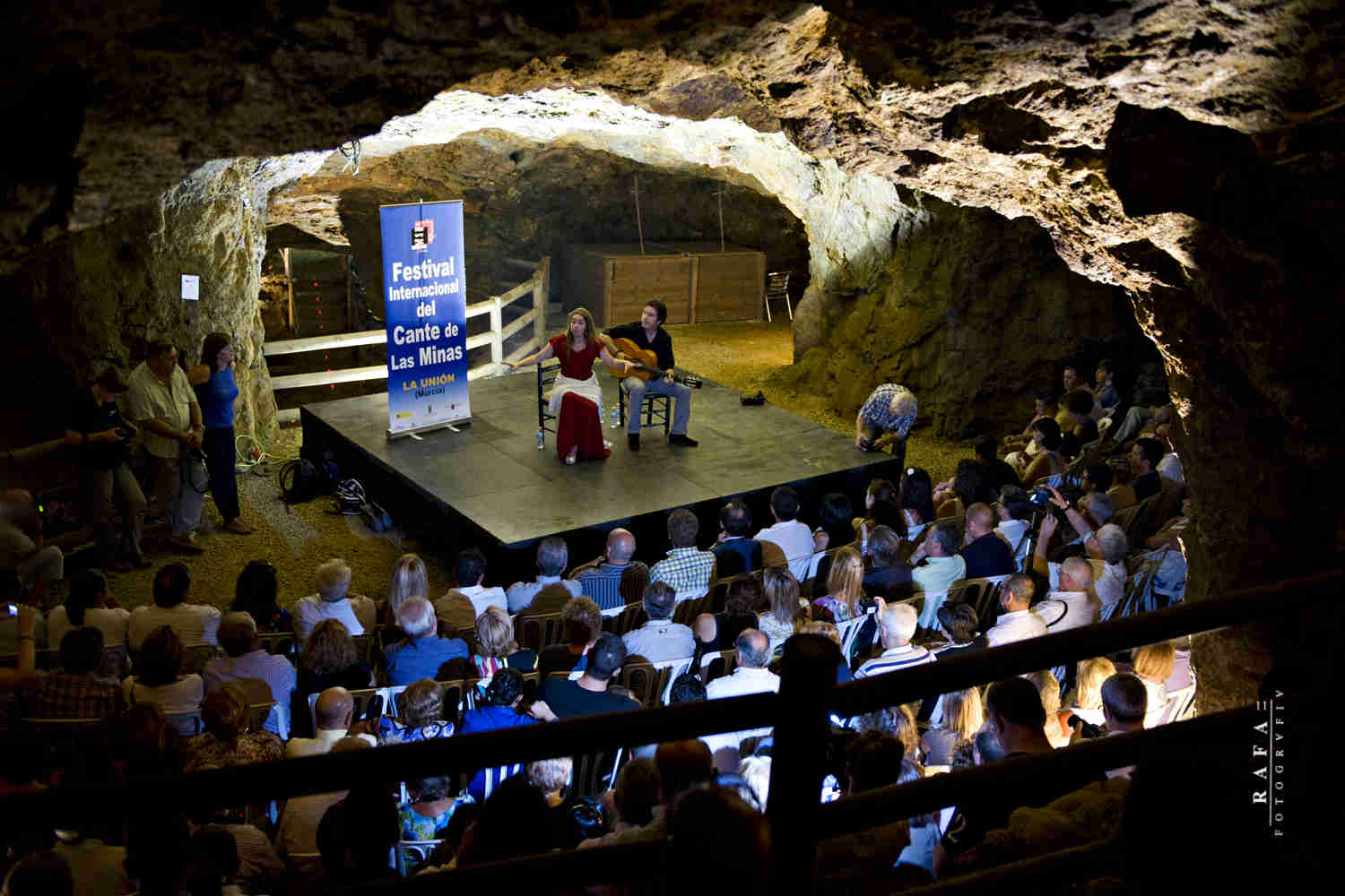
Festival del Cante de las Minas, La Union, Murcia
La Costa Sur
Mazarron
Mazarrón is set in a wide bay which opens up into the Mediterranean Sea. Its coast used to be visited by Phoenician traders, fishermen of every era and by former miners, who used it to unwind after their hard day's work. It's one of the best places to holiday for sun and beach lovers!
Mazarrón is set in a wide bay that opens up into the Mediterranean and has a coastline of 35 km. It has two important urban centres: the port and the town capital, five kilometres from the coast. Since its origin, the name of Mazarrón has been linked to the mining wealth of its mountain ranges, which are rich in lead, zinc, silver, iron, alum and red ochre. In Phoenician, Punic and Roman times, great work was carried out in the mines, leaving behind an abundance of archaeological remains. The Arabs also settled in the area, attracted by its mineral wealth. After the Christian Reconquest, the place known as Casas de los Alumbres de Almazarrón was formed as a consequence of the mines that were opened in the 15th century. Its strategic position turned it into a bastion of defence of the neighbouring lands of Lorca and Cartagena, proof of which may be seen in the numerous defence towers that were built to stop the Saracen advance from Africa.
Mazarrón became very important at the end of the 19th century and beginning of the 20th, during which time iron and galenite were mined. Once the wealth of the mines had been exhausted, Mazarrón developed an important tourist industry and agriculture, and at the same time, promoted its seafaring and fishing tradition. This activity can be seen in the port, with its fish market and shallow-water fishing boats.
As the result of its rich history, the streets of Mazarrón contain interesting monuments. Of special interest are its Town Hall and the Former Cultural Centre, which are of Modernist style and stand as indications of the splendour of the beginning of the century. Behind the Town Hall is the church of San Andrés (16th century), with a beautiful Mudejar coffered ceiling and nearby, the Convent of La Purísima (the patron saint of the town). It is also possible to visit the ruins of the Castle of the Vélez family. Out of the town, there are other towers, such as the Torre de Vieja de la Cumbre (17th century) in the port, the Tower of Los Caballos and the Tower of Santa Isabel in Bolnuevo and, on the hill of El Molinete, a watchtower with a circular layout.
Besides the wealth of monuments, Mazarrón offers beautiful places which stand along the 35 km of its coastline and enjoy the protection of its 300 days of sunshine per year and average temperature of 20ºC. Opposite the Beach of Bolnuevo is one of the most spectacular landscapes of the region, where, on white sandstone, the erosion of the wind and the water has sculpted beautiful shapes, known as Bolnuevo Erosions. Beaches such as La Reya, Bahía, Nares or El Castellar and virgin coves such as Cala Amarilla, La Grúa Beach, Parazuelos, Covaticas, Ballenato, Percheles, etc., offer ideal conditions for beach and sea lovers or for those who enjoy long walks along the seashore.
Playa de Bolnuevo, Mazarron, Murcia
Mazarrón is also the ideal place for enjoying a complete range of leisure possibilities, nautical activities and active tourism. The Mazarrón marina has 200 mooring points. In its regatta club, competition is combined with courses at beginners and advanced levels. It is also possible to practise rowing, sea paragliding, water-skiing and speedboat racing. Divers can also find many clubs that organise courses at all levels together with diving expeditions to enjoy the beauty of the rocky sea bottoms, spectacular underwater caves and grottos.
Mazarrón also has a great deal to offer the rural tourist in the way of scenery and the traditions of its mining and maritime past. Its protected natural areas of Sierra de las Moreras and La Muela Cabo Tiñoso offer the chance of getting closer to nature in an area of great environmental value and interest.
Litoral de Lorca
If you're going with family or friends, as a couple or alone... We have beaches of all types, from small and hidden coves to long stretches of fine sand, and to top it off, they are spread out over two seas. Don't worry, we have the beach you are looking for!
Puntas de Calnegre, Lorca, Murcia
The Borough of Lorca's considerable size obviously bestows it with a gateway to the sea. This stretch of the coast, Puntas de Calnegre to give it a name, is a part of the Cabo Cope - Puntas de Calnegre Regional Park. The main attraction of the thirteen beaches which make up the Lorca coastline is their excellent level of conservation. Anyone who is keen on nature and adventure tourism will enjoy following the route of the GR 92 (Great Footpath 92) which runs parallel to the coast as it crosses gulleys, dry river beds and coves along dirt tracks and natural paths.
Águilas
It is at the southernmost point of the region, bordering Andalusia. Águilas will captivate you with its beaches, history and Mediterranean charm. You don't need to go far if you wish to wander.
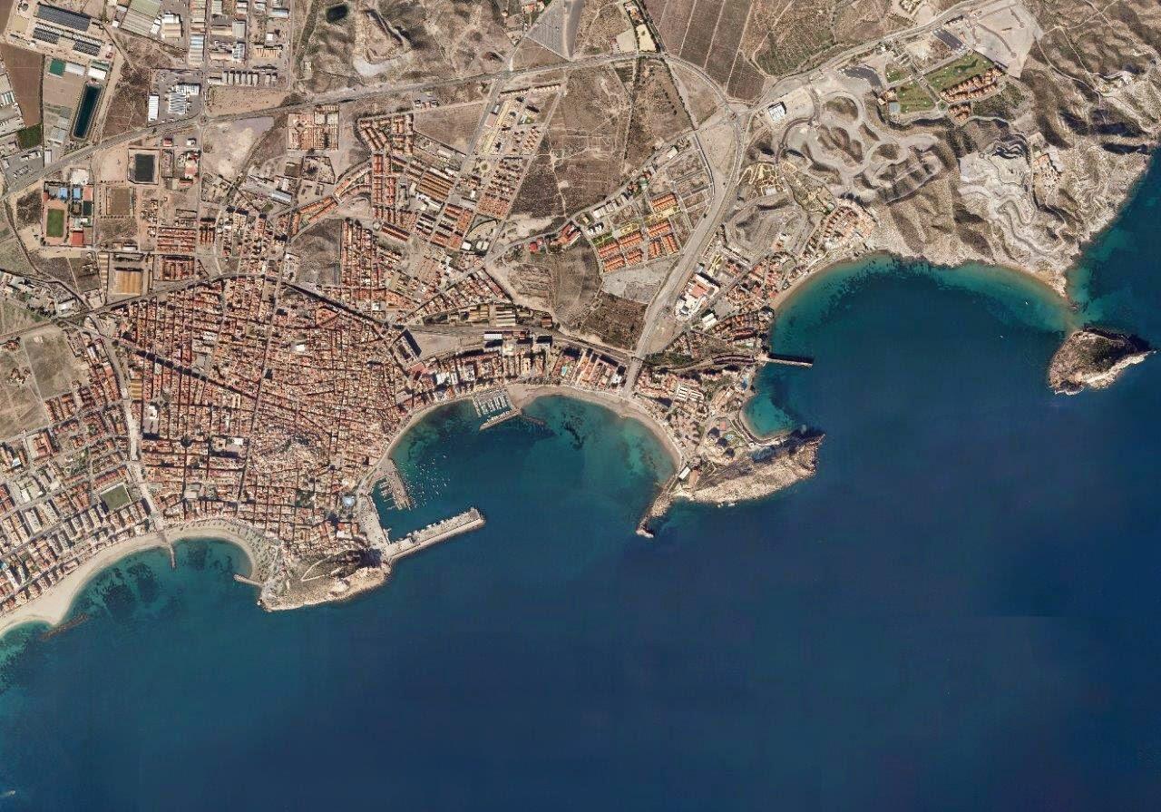
Aguilas, Murcia
This town stands on a coastal area of 35 km, under the surveillance of its beautiful castle of San Juan de las Águilas and on the southern-most tip of the region. This municipality has been inhabited since the Palaeolithic age, and many other cultures, including the Argaric, Phoenician, Roman and Moslem people, have left traces here. Of particular interest are the Roman remains, especially the baths, which date from the 1st to 4th century.
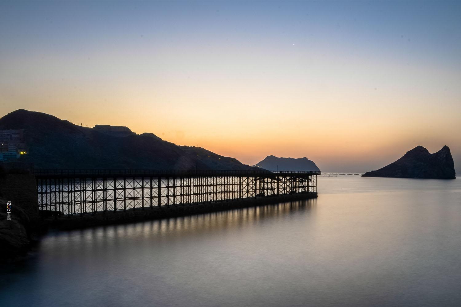
As a modern town, Águilas was born of the enlightened thought of Charles III and his ministers Aranda and Floridablanca, who sought a port for the export of the agricultural products of the river plain of Lorca, and Águilas was the natural departure point for the entire region. The new town, with its rectilinear layout, became a commercial center on the up, reaching its zenith in the 19th century with exploitations of silver, lead and iron and the construction of the railway line and the pier of El Hornillo by British companies. Nowadays, Aguilas conserves its seafaring tradition and its deep-rooted vocation as a tourist resort.
Of the town's monuments, the Town Hall is of particular interest; it is a neo-Mudejar building from the 19th century, located in the Plaza de España, with age-old gardens and an old fountain dominated by a swan, popularly known as "the turkey on the pond". The square is surrounded by a few Modernist buildings, the 19th-century church of San José, which contains the statue of Our Lady of Sorrows, who is the patron saint of the town. The historical quarter still has the environment of the seafaring quarters, dedicated to fishing, and is crowned by the castle-fortress of San Juan de Águilas. This tower-fortress was built around 1579 for defence purposes and was later rebuilt in the 18th century. In the Paseo de Parra, there is a monument to the railway, proof of the importance this means of transport once had for the population.
Besides its wealth of monuments and archaeology, Águilas has a coastline with many points of interest. Thirty-five coves, rocky promontories that stretch into the sea and beaches of fine sand. The coves of Playa de Calarreona, Playa la Calabardina, Playa de Calacerrada , Playa del Arroz, Playa del Hornillo, are places where the protagonist is the countryside, still untouched in places.
Indeed, the town has two protected natural areas: the Regional Park of Cabo Cope and the Protected Countryside of Las Cuatro Calas. The very centre of the town has beaches, such as that of Las Delicias. And nearby, opposite the breakwater of El Hornillo, lies the Isle of El Fraile, a small island covered with rocky slope sea bottoms and seaweed colonies for the special enjoyment of divers. These are joined by the interesting sea bottoms at the foot of the Crag of Cabo Cope. East of Águilas, in the municipality of Lorca, is a coastal area of enormous interest, where we find Puntas de Calnegre - literally Blacklime Points, so-called after the dark colour of the rocks. Together with Cabo Cope, Puntas de Calnegre has been a Regional Park since 1992. This is one of the least frequented areas of the coast, with clean, sandy beaches and crystalline waters. The Points end at the sea in high cliffs, between which lie the beautiful coves of Baño de las Mujeres, Siscal and Cala Honda.
Aguilas, Murcia
The Mediterranean climate of Águilas, with almost no rainfall, 3,200 annual hours of sunlight and average temperatures of 25.2ºC make this place ideal for nautical and sub-aqua tourism. Everything the denomination of Águilas offers (Villa Náutica (sailing village)), has been designed for visitors to get the most out of their stay. Sailing cubs, diving clubs with light sailing boat courses, cruises, diving courses, hire of material, monitors and qualified teachers, tourist accommodation, apartments, hotels and camp sites, etc., all at the disposal of those who decide to pay us a visit.
The coastal town Águilas has even more to offer, given its wide range of choice and alternatives for the enjoyment of rural tourism, with 3 well-signposted walking routes for the more energetic types or long walks simply to take in the views of the spectacular scenery in the area.
FURGOCASA
Planning on hiring a Camper? Check our prices and conditions.
ALICANTE - MADRID - MURCIA
We are waiting for you!!